Iowa Crop Progress and Conditions Report
Week of July 15-21, 2019
DES MOINES, Iowa (July 22, 2019) – Iowa Secretary of Agriculture Mike Naig today commented on the Iowa Crop Progress and Condition report released by the USDA National Agricultural Statistics Service. The report is released weekly from April through November.
“After several days of sweltering heat and limited precipitation, the crops got the rain they needed last weekend,” said Secretary Naig. “Farmers are very grateful for the mild temperatures forecasted over the next several days.”
The weekly report is also available on the USDA’s site at nass.usda.gov/ia.
Crop Report
Iowa farmers had 5.0 days suitable for fieldwork during the week ending July 21, 2019, according to the USDA, National Agricultural Statistic Service. There were some reports of crops lying flat and green snap in corn due to high winds produced from various storms throughout the state. Fieldwork activities included spraying and harvesting hay and oats.
Topsoil moisture condition was rated 2 percent very short, 14 percent short, 78 percent adequate and 6 percent surplus. Districts in the southern third of Iowa and the east central district reported topsoil moisture conditions as over 25 percent short to very short. Subsoil moisture condition was rated 1 percent very short, 9 percent short, 81 percent adequate and 9 percent surplus.
Forty-one percent of the corn crop has begun to silk, 12 days behind last year and 1 week behind the 5-year average. One percent of the crop reached the dough stage, 5 days behind last year and average. Corn condition rated 63 percent good to excellent. Forty-seven percent of the soybean crop has started to bloom, 13 days behind last year and 9 days behind average. Four percent of the crop has started setting pods, nearly 2 weeks behind average. Soybean condition rated 64 percent good to excellent.
Seventy-eight percent of oats started coloring, 4 days behind last year and 5 days behind average. Twelve percent of the oat crop has been harvested for grain, 9 days behind last year and average. Oat condition declined slightly from the previous week to 61 percent good to excellent. The second cutting of alfalfa hay reached 56 percent, 11 days behind last year and 8 days behind average. Hay condition rated 61 percent good to excellent. Pasture condition declined for the third straight week with 61 percent good to excellent. High temperatures this past week caused some stress to livestock.
Weather Summary
Provided by Justin Glisan, Ph.D., State Climatologist, Iowa Department of Agriculture and Land Stewardship
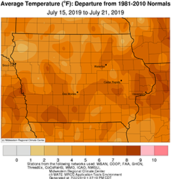
Thunderstorm activity was present across Iowa on nearly every day of the reporting period with much of the state reporting above average rainfall. A large dome of high pressure over the Midwest also brought very hot conditions, including triple digit heat indices Wednesday through Friday. The statewide average temperature was 79.6 degrees, 4.5 degrees above normal. Iowa experienced spotty showers and thunderstorms during the afternoon and evening on Sunday (14th) with Dubuque Lock and Dam (Dubuque County) reporting 0.53 inch of rain. High temperatures were in the upper 80s and lower 90s with the average high at 90 degrees, five degrees above normal.
Light rain showers formed across northern Iowa into Monday (15th) morning with only a handful of stations reporting measurable totals. Tuesday (16th) was a sunny and breezy day with winds out of the south. High temperatures were in the mid to upper 80s, one to two degrees above average. Moisture from the remains of Tropical Storm Barry helped thunderstorms form across Iowa’s northern half around midnight. The storms consolidated into a well-organized squall line that propagated from northwestern Iowa to the southeastern corner during the daytime hours on Wednesday (17th). There were several reports of severe straight-line winds across nine counties in northwest and southeast Iowa; Harlan (Shelby County) and Mediapolis (Des Moines County) observed 70 mph wind gusts.
A line of storms re-fired around midnight and extended into central Iowa early Thursday (18th) morning. Much of Iowa received measurable rainfall over the 24-hour period ending at 7 a.m. with multiple locations experiencing torrential downpours from stronger storms, especially across northern and south-central Iowa. Osage (Mitchell County) reported 2.60 inches while Rathbun Dam (Appanoose County) observed 1.98 inches. Statewide average precipitation was 0.70 inch, 0.54 inch above average. Temperatures varied from cooler than average in locations along the path of the squall to above average in southern and eastern Iowa.
As Thursday progressed, the band of thunderstorms gradually dissipated. In the absence of cloud cover and rainfall, highs were able to reach into the 90s, creating uncomfortable conditions. Overnight lows remained in the 70s across the state with pockets of low 80s in southwestern Iowa. The average minimum statewide temperature was 74 degrees, 11 degrees above average.
Friday (19th) was sweltering across Iowa as highs climbed into the lower 90s north and middle 90s south. Dew point temperatures were also in the upper 70s and lower 80s. The combination of heat and humidity boosted heat indices into triple digits under clear skies; Le Mars Municipal Airport (Plymouth County) reported 120 degrees while Keokuk Municipal Airport (Lee County) observed 110 degrees. The statewide average temperature was 92 degrees, eight degrees above average. Overnight lows mirrored what was experienced Thursday night.
Saturday (20th) was an active weather day with severe straight-line winds reported across 29 counties as a system of strong thunderstorms moved through Iowa. A majority of the state reported measurable rainfall, ranging from 0.10 inch in Dubuque (Dubuque County) to 1.95 inches in Knoxville (Marion County).
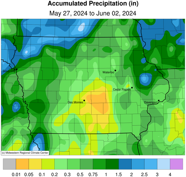
Light rain continued into Sunday (21st) morning in southern Iowa as a cold front moved through the state, bringing much cooler conditions. Weekly rainfall totals ranged from 0.11 inch at Fulton (Jackson County) and Le Claire Lock and Dam (Scott County) to 4.91 inches at Estherville Municipal Airport (Emmet County). The statewide weekly average precipitation was 1.51 inches while the normal is 1.01 inches. The week’s high temperature of 99 degrees was reported on the 19th in Little Sioux (Harrison County), 13 degrees above average. Sibley (Osceola County) reported the week’s low temperature of 56 degrees on the 21st, four degrees below average. A maximum overnight low of 81 degrees was reported on the 19th at airports in Davenport (Scott County) and Ottumwa (Wapello County); these readings were 16 and 18 degrees above average, respectively.

