Iowa Crop Progress and Conditions Report
Oct. 14-20, 2019
DES MOINES, Iowa (Oct. 21, 2019) – Iowa Secretary of Agriculture Mike Naig today commented on the Iowa Crop Progress and Conditions report released by the USDA National Agricultural Statistics Service. The report is released weekly from April through November.
“The state experienced dry and windy weather conditions last week, which gave farmers several good days to harvest before the rainy weekend,” said Secretary Naig. “Farmers are hoping the favorable weather returns to help crops dry-down in the fields.”
The weekly report is also available on the USDA’s site at nass.usda.gov.
Crop Report
Field conditions throughout Iowa improved allowing farmers 5.1 days suitable for fieldwork during the week ending October 20, 2019, according to the USDA, National Agricultural Statistics Service. Fieldwork activities included chopping silage; applying fertilizer and manure; and harvesting hay, seed corn, soybeans, and corn for grain.
Topsoil moisture condition was rated 0 percent very short, 1 percent short, 78 percent adequate and 21 percent surplus. Subsoil moisture condition was rated 0 percent very short, 2 percent short, 78 percent adequate and 20 percent surplus.
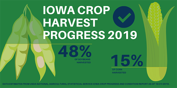
Eighty-seven percent of the corn crop has reached maturity, 3 weeks behind last year and over 2 weeks behind the 5-year average. Fifteen percent of the crop has been harvested for grain, 11 days behind average. Corn condition rated 66 percent good to excellent.
Ninety-four percent of the soybean crop has begun dropping leaves or beyond, 9 days behind average. Over 30 percent of the State’s expected soybean crop was harvested during the week ending October 20, 2019. This brought the total harvested to 48 percent statewide, 4 days ahead of last year but 5 days behind average. This marks the first time the 2019 soybean crop has been ahead of the 2018 soybean crop; harvest of last year’s crop was also behind average due to wet field conditions. Soybean condition rated 65 percent good to excellent.
The third cutting of alfalfa hay is nearly complete at 97 percent, almost 3 weeks behind average. Pasture condition improved from the previous week to 50 percent good to excellent which was the highest rating since the first week of August. Feedlots remain muddy.
Weather Summary
Provided by Justin Glisan, Ph.D., State Climatologist, Iowa Department of Agriculture and Land Stewardship
A notable pattern shift away from the recent active weather pattern to dominant high pressure systems across the Midwest brought unseasonably dry conditions across Iowa during the reporting period. Statewide precipitation departures were generally 0.60 to 0.80 inches below normal. Cooler than normal conditions also continued across Iowa with temperature departures up to six degrees below average. The statewide average temperature was 48.0 degrees, 2.8 degrees colder than expected.
Cloud cover gradually cleared from southwest to northeast through the afternoon and evening hours on Sunday (13th). Clear skies in southern Iowa allowed high temperatures to reach into the upper 50s and lower 60s. Temperatures across the rest of Iowa remained in the mid to upper 40s, up to 20 degrees below normal. The statewide average high was 51 degrees, 12 degrees cooler than expected.
Overnight lows into Monday (14th) also remained below average as skies completely cleared. Calm winds across northern Iowa helped temperatures dip into the upper 20s and low 30s while southern Iowa experienced lows in the mid 30s. With high pressure dominating the Upper Midwest, southerly winds and clear skies produced pleasant conditions. Some stations in southwestern Iowa reported highs in the low 70s with upper 50s and low-to-mid 60s prevailing across the rest of the state.
A weak low pressure system propagated across northern Iowa into Minnesota on Tuesday (15th). The attendant cold front swept across the state, producing gusty northwest winds. Daytime temperatures remained in the low 50s north to upper 50s south. Wednesday was an unseasonably cool day statewide as a cold air mass sat over Iowa. Cloudy skies and northwesterly winds held daytime temperatures in the mid to upper 40s with low 50s in southeastern Iowa.
Skies cleared into Thursday (17th) as another high pressure system moved into Iowa allowing highs to reach into the 60s across the state. Overnight lows dropped into the mid to upper 40s, up to 11 degrees below normal.
Friday (18th) was an unseasonably warm day under sunny skies. High temperatures reached in the low to mid 70s, up to 16 degrees warmer than expected with the average statewide high of 70 degrees. Strong and sustained southerly winds were in the general range of 20 to 30 mph with gusts topping 40 mph; Shenandoah Municipal Airport (Page County) reported a peak wind gust of 45 mph.
Winds shifted to a northerly direction during late evening and overnight into Saturday (19th) as a cold front began pushing through Iowa. Light rain showers accompanied the front, bringing the first measurable rainfall of the reporting period to Iowa’s western half. Totals at 7 a.m. ranged from 0.10 inches across many stations to 0.26 inches in Corning (Adams County). The front cleared the state during the evening hours. Clearing conditions behind the system allowed highs to reach into the mid 60s across western Iowa with temperatures in the mid to upper 50s where cloud cover was present.
Weekly precipitation totals ranged from no accumulation at multiple stations to 0.59 inches at Ames Municipal Airport (Story County). The statewide weekly average precipitation was 0.12 inches, while the normal is 0.56 inches. The week’s high temperature of 78 degrees was reported on the 18th at Little Sioux (Harrison County), 15 degrees above average. Multiple stations across northern Iowa reported the week’s low temperature of 24 degrees on the 14th. This reading was on average 15 degrees below normal.
