Iowa Crop Progress and Conditions Report
Oct. 28-Nov. 3, 2019
DES MOINES, Iowa (Nov. 4, 2019) — Iowa Secretary of Agriculture Mike Naig today commented on the Iowa Crop Progress and Conditions report released by the USDA National Agricultural Statistics Service. The report is released weekly from April through November.
“This week brought the first measureable snowfall of the season, which added even more moisture to already wet soil and continued to prevent corn from drying down in the field,” said Secretary Naig. “Parts of the state made significant progress and are getting close to finishing up their soybeans.”
“We’re hearing reports of propane shortages across the state,” said Naig. “I’m working with Gov. Reynolds and the Iowa Propane Gas Association to monitor the situation. The emergency proclamation extending driving hours will help alleviate the delivery issues and supplies will increase as some farmers start wrapping up harvest.”
The weekly report is also available on the USDA’s website at nass.usda.gov.
Crop Report
Iowa farmers continued to deal with challenging field conditions as the first accumulating snowfall of the year fell across parts of the state during the week ending November 3, 2019, according to the USDA, National Agricultural Statistics Service. Statewide there were 4.4 days suitable for fieldwork. Fieldwork activities included harvesting soybeans and corn for grain, spreading manure, applying anhydrous, baling corn stalks and fall tillage.
Topsoil moisture condition was rated 0 percent very short, 1 percent short, 81 percent adequate and 18 percent surplus. Subsoil moisture condition was rated 0 percent very short, 2 percent short, 81 percent adequate and 17 percent surplus.
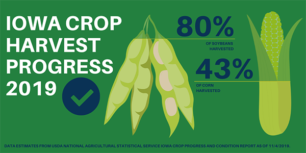
Forty-three percent of the corn crop has been harvested for grain, 8 days behind last year and 11 days behind the 5-year average. Producers in the north central district were able to harvest over one quarter of their expected crop this past week. Moisture content of field corn being harvested for grain was at 21 percent. Corn condition rated 67 percent good to excellent.
Eighty percent of the soybean crop has been harvested, 3 days behind last year and 1 week behind average. Areas in Iowa are still dealing with muddy feedlots, while others reported no livestock issues this past week.
Weather Summary
Provided by Justin Glisan, Ph.D., State Climatologist, Iowa Department of Agriculture and Land Stewardship
A southerly dip in the jet stream brought multiple fast-moving winter-type systems through Iowa during the reporting period. This marks the first time this season that widespread accumulating snow fell across Iowa. Though much of Iowa reported above average snowfall, below average precipitation was observed statewide. With the jet stream locked in a more southerly configuration, colder than average temperatures continued to grip the state; Iowa’s average temperature was 33.0 degrees, 12.6 degrees below normal.
The cold front traversing the state moved out of eastern Iowa during the late evening hours on Sunday (27th). Overcast skies and brisk northwesterly wind kept daytime highs in the low to mid 40s across Iowa’s western two-thirds. Prior to the frontal passage, highs in eastern Iowa reached into the upper 50s.
Overnight lows into Monday (28th) remained in the 30s as cloud cover gradually cleared. Partly to mostly sunny skies prevailed across much of north-central Iowa as the afternoon progressed with highs reaching into the upper 30s to lower 40s. During the evening and nighttime hours, the first widespread snow event of the season developed as a system moved across Iowa. Measurable snow was reported across the southeastern two-thirds of the state with the highest totals in east-central Iowa. Accumulations ranged from a trace at multiple stations to 4.2 inches in Coralville (Johnson County) with the statewide average of 1.20 inches. Tuesday (29th) started chilly, with overnight lows in the mid to upper 20s. Skies cleared throughout the day, though cloud cover returned in advance of the next weather event to move through Iowa.
A second weather system greeted the state with snow on Wednesday (30th) as a low pressure center south of Iowa propagated east. As with the first system, accumulating snow was confined to southeastern Iowa. Stations from Cedar Rapids (Lynn County) reported totals in the three to four-inch range with Davenport Municipal Airport (Scott County) and Dubuque (Dubuque County) observing 3.00 inches and 5.20 inches, respectively. Totals below an inch were reported from Decorah (Winneshiek County) to Creston (Union County); the statewide average snowfall was 1.60 inches. Daytime highs remained in the 30s, averaging 20 degrees below the statewide normal of 55 degrees.
The system moved out of eastern Iowa on Thursday (31st) morning with gradually clearing skies into the evening hours. Highs reached into upper 30s and low 40s. Winds shifted from a southerly direction overnight into Friday (1st), keeping temperatures in the low 30s. Light rain showers moved across Iowa during the daytime hours, leaving totals generally under 0.10 inches with Jefferson (Greene County) reporting 0.14 inches.
Warmer temperatures were reported across Iowa on Saturday (2nd) under partly sunny skies. Highs reached into the mid to upper 40s, though these readings were still unseasonably cool. Partly cloudy conditions continued into Sunday (3rd) morning, as overnight lows dropped into the upper 20s east and low 30s west.
Weekly precipitation totals ranged from no accumulation at multiple stations in northwest Iowa to 1.01 inches in Camanche (Clinton County). The statewide weekly average precipitation was 0.21 inches, while the normal is 0.55 inches. The average snowfall across Iowa was 2.40 inches.
The week’s high temperature of 63 degrees was reported on the 28th at Bellevue Lock and Dam (Jackson County) and Keokuk Lock and Dam (Lee County), on average four degrees above normal. The week’s low temperature of 13 degrees was reported on the 31st in Sanborn (O’Brien County) and on the 1st at Dubuque Regional Airport (Dubuque County) and Sibley (Osceola County). The reading was on average 19 degrees below normal. Soil temperatures as of Sunday were generally in the low 40s.
