Iowa Crop Progress and Condition Report
May 17 - 23, 2021
DES MOINES, Iowa (May 24, 2021) — Iowa Secretary of Agriculture Mike Naig today commented on the Iowa Crop Progress and Condition report released by the USDA National Agricultural Statistics Service. The report is released weekly from April through November.
“A notable shift in the weather brought warmer and wetter conditions across much of Iowa last week as many farmers wrapped up planting,” said Secretary Naig. “Cooler temperatures have led to emergence issues in some areas, but warmer weather forecasted for this week should really push the crop along.”
The weekly report is also available on the USDA’s website at nass.usda.gov.
Crop Report
Persistent precipitation limited opportunities for farmers to plant corn or soybeans during the week ending May 23, 2021 according to the USDA, National Agricultural Statistics Service. Statewide there were just 2.4 days suitable for fieldwork during the week. Where possible, field activities included planting and spraying.
Topsoil moisture levels rated 3% very short, 15% short, 71% adequate and 11% surplus. Subsoil moisture levels rated 11% very short, 29% short, 54% adequate and 6% surplus.
Planting of Iowa’s expected corn crop is nearly complete at 97%, two weeks ahead of the 5-year average. Corn emergence reached 75%, 5 days ahead of normal. Iowa’s first corn condition rating of the season showed 0% very poor, 1% poor, 21% fair, 64% good and 14% excellent. Eighty-nine percent of the soybean crop has been planted, 15 days ahead of normal. Soybeans emerged jumped 29 percentage points during the week, to 53%, 9 days ahead of the 5-year average. Farmers in south central and southeast Iowa still have at least 20% of their soybean crop to plant but some areas may need a few days to dry out enough to allow field work to resume. Ninety-six percent of the oat crop has emerged and 8% of oats have headed. Iowa’s oat condition rated 62% good to excellent.
Six percent of the State’s first cutting of alfalfa hay has been completed. Iowa’s hay condition rating rose to 59% good to excellent. Pasture condition improved to 49% good to excellent. Warmer temperatures and rain have promoted good pasture and hay growth. Overall, livestock conditions are good, however, some producers reported muddy feedlots. Some cows and calves have been turned out on grass.
Weather Summary
Provided by Justin Glisan, Ph.D., State Climatologist, Iowa Department of Agriculture and Land Stewardship
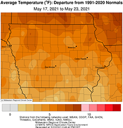
A significant shift in the jet stream pulled moisture from the Gulf of Mexico into the Midwest bringing much needed rainfall across the state during the reporting period. A northward bulge in the atmospheric circulation pattern also broke a streak of cooler than normal temperatures as Iowa experienced unseasonably warm conditions; the statewide average temperature was 67.6 degrees, 4.2 degrees above normal.
Dreary conditions persisted across southern Iowa through Sunday (16th) afternoon as rain showers propagated west to east. Daytime temperatures pushed into the low 70s in northwestern Iowa where the sun was shining as opposed to the upper 50s and low 60s where clouds were present. Rain totals reported at 7:00 am on Monday (17th) were highest south of Interstate 80 with widespread totals above 0.50 inch; Community Collaborative Rain, Hail and Snow (CoCoRaHS) gauges in Creston (Union County) and College Springs (Page County) measured 1.18 inches. Showers remained across southeastern Iowa into the early afternoon as overcast skies blanketed the state with temperatures in the mid 60s to low 70s. A low pressure center over Missouri streamed showers into eastern Iowa overnight into Tuesday (18th) with morning lows in the upper 50s and low 60s and an easterly wind. Rain continued across much of Iowa’s eastern third into the nighttime hours as winds shifted to a southerly direction. A warm front lifted north over Iowa early Wednesday (19th) ahead of another disturbance that brought a complex of showers in western Iowa. As the day progressed, more showers and a few thunderstorms moved south to north through Iowa, bringing widespread rainfall to a majority of reporting stations. Even with cloud cover, a warmer air mass pushed temperatures into the low 70s north to upper 70s south, creating muggy conditions. Rain totals were generally above a tenth of an inch with pockets of 0.50 inch to 0.75 inch in southwestern and northwestern Iowa; several rain gauges in Dickinson County reported over an inch with the statewide average rainfall at 0.28 inch.
With adequate moisture flowing into the Midwest, rain continued over Iowa through Thursday (20th) with a swath of 0.50 inch to 1.50 inches from the southwest through north-central Iowa. A discrete thunderstorm spawned a weak tornado over northwestern Dallas County during the evening with heavy downpours in certain locations; no damage was reported. Over 20 stations reported an inch or more with Boone (Boone County) picking up 2.14 inches. Overnight lows into Friday (21st) remained unseasonably warm under cloud cover and southerly winds; temperatures stuck in the mid to upper 60s with a statewide average low of 64 degrees, 13 degrees above normal. Rain lingered in eastern Iowa until the disturbance pushed out of the state. Clearing skies allowed temperatures to climb into the low 80s at some stations in northwestern Iowa. Another system propagating across western Missouri brought additional rainfall over portions of Iowa through Saturday (22nd) before dissipating as the sun set. Daytime highs ranged from low 80s northwest to mid 70s southeast where rain was present. Event totals reported on Sunday (23rd) morning were generally light though southeastern Iowa had pockets of higher amounts with Salem (Henry County) observing 0.66 inch.
Weekly precipitation totals ranged from 0.14 inch at Rock Valley (Sioux County) to 3.20 inches in Clarinda (Page County). The statewide weekly average precipitation was 1.24 inches while the normal is 0.99 inch. Sibley (Osceola County) and Spencer Municipal Airport (Clay County) observed the week’s high temperature of 86 degrees on the 22nd, on average 14 degrees above normal. Estherville (Clayton County) reported the week’s low temperature of 42 degrees on the 17th, five degrees below normal.