Iowa Annual Weather Summary – 2025
General Summary
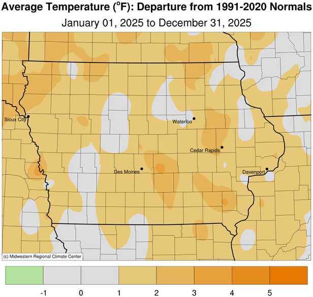
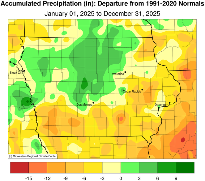
Statewide annual temperatures averaged 49.7 degrees or 1.3 degrees above normal, tying 1973 and 1999 as the 25th warmest year on record. Annual precipitation averaged 33.59 inches or 1.96 inches less than normal, ranking as the 91st driest/63rd wettest year on record. A warmer year occurred just last year (5th warmest) while 2023 (2024) was drier (wetter).
Justin M. Glisan, Ph.D.
State Climatologist of Iowa
Iowa Dept. of Agriculture & Land Stewardship
Wallace State Office Bldg.
Des Moines, IA 50319
Telephone; (515) 281-8981
E-mail: [email protected]